Tracking Tropical Disturbances: Invest AL90 and AL99 in the Atlantic Ocean
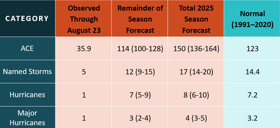
As hurricane season progresses, meteorologists are closely monitoring two weather systems in the Atlantic Ocean. The National Hurricane Center in Miami, Florida, has identified two disturbances, known as Invest AL90 and Invest AL99, which have the potential to develop into tropical storms. The Atlantic hurricane season typically peaks between August and October, and the next storm to form would be named Fernand. While four tropical waves are also being tracked in the Caribbean, they are currently not posing any immediate threats.
Invest AL90, located in the southwestern Atlantic, is showing signs of organization and is expected to become a tropical depression soon. It may intensify into a tropical storm as it moves northward. Meanwhile, Invest AL99, east of the Windward Islands, is a disorganized system that could develop over the next few days. Locally heavy rainfall and gusty winds are possible in the Windward Islands as the system progresses. The National Hurricane Center is keeping a close eye on these disturbances and advises residents to stay informed and prepared for any potential developments.
In addition to the two invest systems, there are four tropical waves in the Atlantic that are currently moving westward without posing any immediate threats. The USA TODAY Network in Florida will provide daily updates on tropical weather conditions, and it is important to stay connected to local news sources for the latest information. As hurricane season continues until November 30, it is crucial to remain vigilant and prepared for any potential storms that may arise.